
About
I am a final year student, at the Technical University of Kenya, pursuing a Bsc. of Applied Science in Geoinformatics.. I was also attached to the Kenya Forestry Service, both as a prerequisite for graduation and in achievance of a dream employing geospatial know-how to help in natural resource management. I'm currently working on serverside and clientside Reference Implementations for select Open Geospatial Consortium Standards using TypeScript
Work Experience
Skills
Check out my latest work
I've worked on a variety of projects, from simple websites to complex web applications. Here are a few of my favorites.
Typescript types for CoverageJSON, a JSON extension for spatiotemporal collections. This project is intended to improve dev experience when generating CoverageJSON documents

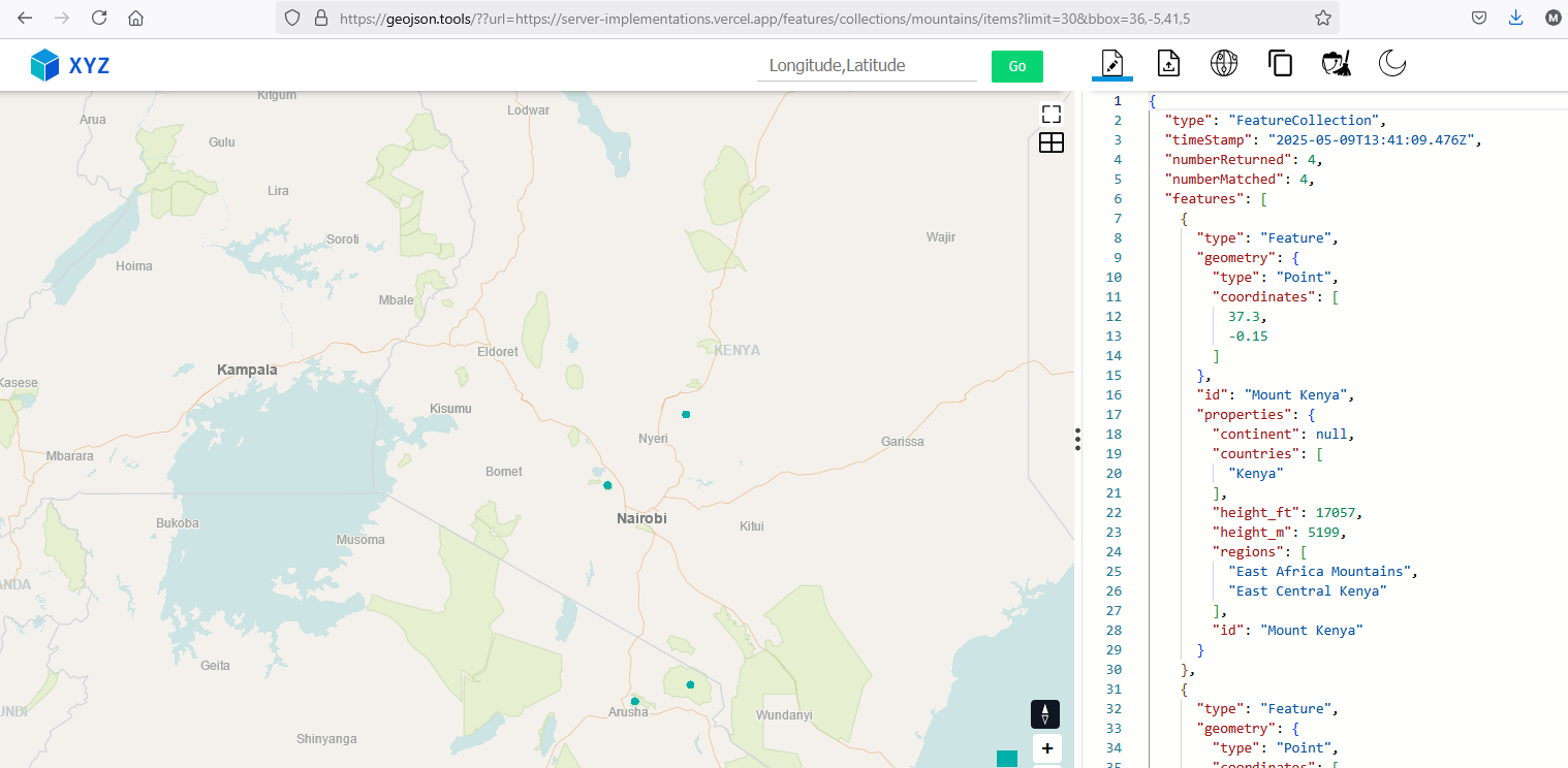
Part of OGC API Server Implementations:
Query/sample spatio-temporal collections using consistent patterns.
Endpoints support select Well Known Text geometries paired with intuitive endpoint names. For example:
Trajectory endpoint supports LineString and MultiLineString wkt without additional paramers
Locations and Items endpoints support are largely similarly. This allows reusability as an OGC API Features implementation
and many others. See the Definition document for more info.
The API also supports realtime updates to collections via WebSockets
Part of OGC API serverside reference implementations:
Request geospatial data from APIs consistently and quickly.
Implements Part 1 & Part 2
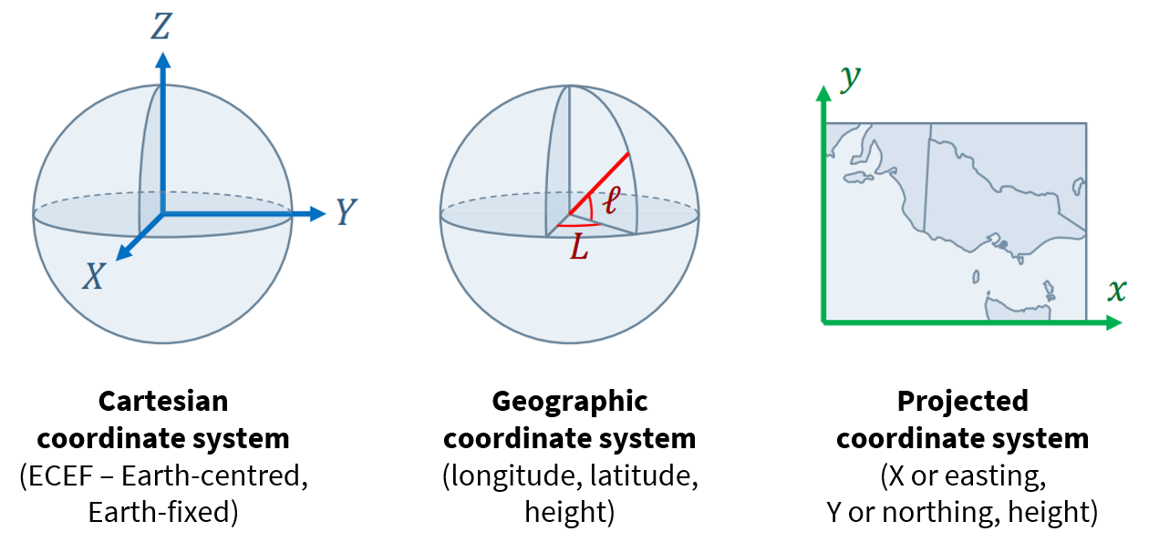
A curated list of Spatial Reference Systems natively supported by PostGIS. Each member has the following attributes:
- srid: An EPSG code
- flipCoordinates: A boolean (flipCoordinates) that informs whether axis order is Longitude,Latitude or not
- crs: an URI pointing to a OGC CRS definition document as well as the authority governing the definition
- wkt: A WKTv2 string representing the parameters of the CRS
- and others such as authority, code, version